


st_toeff5

My Switzerland
Optez pour le retour à la nature GUIDE+

Length
432 km

Max alt
2451 m

Uphill gradient
21591 m
Km-Effort
717 km

Min alt
242 m

Downhill gradient
20851 m
Boucle
No
Creation date :
2014-12-10 00:00:00.0
Updated on :
2014-12-10 00:00:00.0
88h06
Difficulty : Unknown

FREE GPS app for hiking
 SityTrail
IGN / Geographical institutes
SityTrail Plus
The world is yours!
About
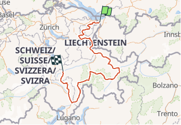
Trail Walking of 432 km to be discovered at Sankt Gallen, Wahlkreis Rheintal, St. Margrethen. This trail is proposed by My Switzerland.
Positioning
Country:
Switzerland
Region :
Sankt Gallen
Department/Province :
Wahlkreis Rheintal
Municipality :
St. Margrethen
Location:
Unknown
Start:(Dec)
Start:(UTM)
548988 ; 5255548 (32T) N.
Comments